Yeah, it is. Lol.
Or at least parts of it are but its a continent.
A very big country.
Those parts are larger than European countries but foreigners seem to like to assume Australia is one thing.
But that’s the thing about Australia.
It’s not just one thing.
It’s many things.
This map roughly shows the outback (highlighted in red). For some context half way up the east coast you will see the Queensland and New South Wales border.
At that point it’s about an 11 hour drive directly west to reach the outback.
The maps not completely accurate (I didn’t make it) but it will suffice for demonstrational purposes.
Also, ignore the arrow, it’s the remnant of an earlier non relevant post.
I wrote the following answer about a year and a half ago for another question but I think it suits this one too because it shows the range of landscapes you can expect to find in Australia, where they are and how much land they cover.
“I apologize but I need to begin by stating the obvious.
Australia is huge.
it’s an important point.Almost exactly the same size as the contiguous United States but unlike the United States with its 340 odd million people, Australia has a population of only 24 million and contextually, is almost entirely empty.
It’s also extremely ecologically diverse and not just all desert as some people believe.
We have HUGE (European country-sized) regions of rainforest, wetlands, alpine forests, snow-covered mountain ranges, Savanna, rivers, lakes, and everything in between.
We also have 50 thousand kilometers of coastline with over 10 thousand of the most pristine and deserted white sandy beaches found anywhere in the world.Here’s a visual of the size comparison between Australia and the United States.
Here’s another of Australia superimposed to scale over Europe.
(I added the red dots to indicate the major population centers).
In geological terms, it’s also the oldest continent on the planet.
It was already ancient before the Himalayas were thrust up through the earth’s mantle.There are areas of Australia that you can literally feel the eons rise up through your feet and hit you in the chest.
It’s a strange sensation and difficult to describe but anybody who has walked up to Uluru can testify that it’s both real and palpable.The Great Australian Bight:
The Bight is located on the edge of the Nullarbor Plain – to the uninitiated or unobservant, that vast tract of emptiness.
The Bight came into existence when Gondwana separated from Antarctica 50 million years ago. Those cliffs continue precisely like that, unbroken and without deviation or change for over 1200 kilometers.Uluru and Kata Tjuta:
Uluru is the second largest stone monolith in the world.
Kata Tjuta can be seen in the background.
(Mount Augustus in Western Australia is the largest)
Comprised of Sandstone, they were thrust up during the mountain building phase referred to as the Petermann Orgeny that took place in the late Neoproterozoic to early Cambrian times 550–530 Ma (2.75billion years ago).
For some context notice the Uluru-Kata Tjuta Cultural complex in the bottom right corner.The Great Barrier Reef:
The Great Barrier Reef is the world’s largest coral reef system composed of over 2,900 individual reefs and 900 islands stretching for over 2,300 kilometers (1,400 mi) along the Queensland coast.
The Gulf of Carpenteria:
The Gulf of Carpentaria is a large, shallow, warm tropical sea enclosed on three sides by northern Australia and bounded on the north by the eastern Arafura sea.
Its home to an abundance of wildlife including many species of fish, turtles, Sea Eagles, Saltwater Crocodiles and sharks and is often impacted by cyclones.The Great Dividing Range:
The great Dividing Range is the main watershed for eastern Australia.
It comprises a series of plateaus and mountain ranges roughly paralleling the coasts of Queensland, New South Wales, and Victoria for 2,300 miles (3,700 km).
The Wollemi National Park is also home to the Wollemi Pine, a species of Araucariaceae which was only known [globally] from fossil records until 1995 when an entire gorge was found in an undisclosed location full of them. They had previously been thought to have been extinct for over 200 million years.This also very acutely describes Australia broadly.
It’s so large and so empty that broadly, we still don’t even know a lot about what’s out there.
New species are discovered all the time. Ore and oil and gas deposits too.
The last Indigenous tribe only made first contact in 1984 and there are whisperings of another as yet uncontacted tribe still out there.>The Blue Mountains:
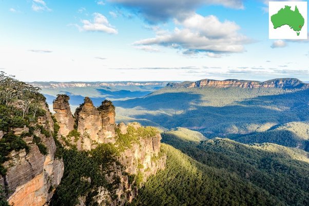
The Blue Mountains are located approximately 90 kilometres west of Sydney and were the first major obstacle early European Explorers had to overcome in their westward expansion into the continent.
Indeed it took them 30 years to find a route through the heavy bush and around the sheer 1000 foot sandstone cliff faces.The three stone monoliths on the left hand side are known as the Three Sisters.
An ancient aboriginal legend tells the tale of three sisters – ‘Meehni’, ‘Wimlah’ and Gunnedoo’ who lived in the heart of the Jamison Valley as part of the Katoomba tribe.
Their hearts were captured by three brothers from a neighbouring tribe, however the law of the land forbid the girls from following their desires and marrying outside their own people.The brothers decided to capture the girls and carry them away to be wed, a major battle ensued as the two tribes clashed and the blood ran thick.
A kindly witchdoctor from the Katoomba tribe feared for the safety of the girls and cast a spell to turn them to stone to keep them safe from harm but unfortunately during the battle the witchdoctor was killed and therefore unable to reverse the spell.>The Snowy Mountains:
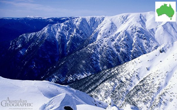
Did you know that Australia receives more annual snowfall than the Swiss Alps.
The Snowy Mountains (or “Snowies”) are the highest mountain range in Australia reaching over 7 thousand feet and located along the Victorian / New South Wales border.
If you’re interested I would highly recommend the movie The Man from Snowy River.
Kirk Douglas was in it.
The Flinders Ranges:
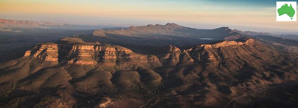
The Flinders Ranges are the largest mountain range in South Australia.
They start about 200 km (125 mi) north of Adelaide and stretch over 430 km (265 mi) from Port Pirie to Lake Callabonna and have been home to the Adnyamathanha people for upwards of 60 thousand years.The Murray River:
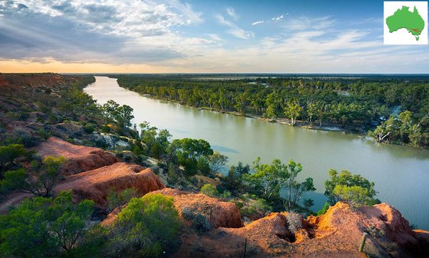
Australia has many large lakes, wetlands, and inland river systems including this one, The Murray River.
The Murray is 2,508 kilometers (1,558 mi) in length. Its headwaters begin in the Snowy Mountains then it flow down marking most of the border between New South Wales and Victoria before meandering through the inland plains and outback, through the Coorong national parks and wetlands to eventually reach the Southern Ocean on the South Australian coast.
Paddlewheel riverboats have been plying their trade along its banks since colonial times, much like the Mississippi.Australia has nine major inland river systems and countless medium and minor.
The other eight major rivers are:
The Murrumbidgee River -1485 km (923 mi), The Darling – 1472 km(915 mi), The Lachlan – 1448 km (900 mi), The Warrego – 1380 (857 mi), Cooper Creek – 1300 km (808 mi), The Paroo River – 1210 km (752 mi), The Diamontina – 900 km (559.234 mi), The Ord – 650 km (400 mi).The Macdonnell Ranges:
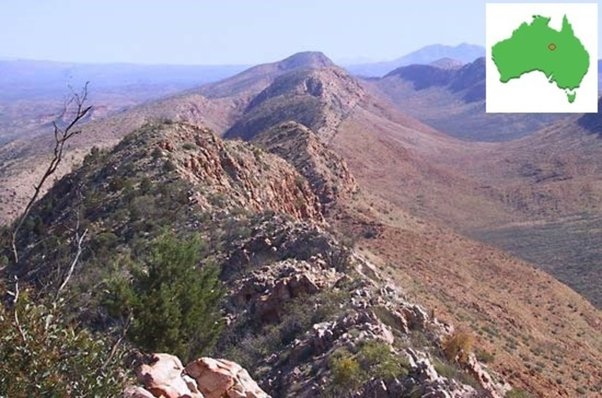
The Macdonnell Ranges are one of the oldest mountain range in the world and the very heart of the continent and the living embodiment of the Aboriginal Dreamtime.
I have spent much of my life working in and around the Macdonnell Ranges from the time I was 14 years old.
They’re BILLIONS of years old and absolutely vibrate with age.(Edit) – Sorry, I noticed something interesting in this photo.
The reason Australia doesn’t have any very high mountain ranges like Europe, Asia and North and South America is because of its age.
The mountains have just had such a long time to erode and you can see it clearly in this photo.
Imagine where the depth of the valley was originally on the right side.
Much deeper than the flat area in the foreground.
Also, notice how high the mountains must have been and note how the valley has been filled by the erosion of the ranges.
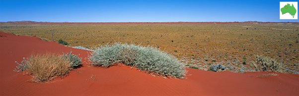
This is also the reason most of central Australia is sand and its also the reason the sand of central Australia is red.
The high iron content in the soil has had so many countless millennia to literally rust.]Christmas Island:
Christmas Island is an external Australian territory in the Indian Ocean 1550 kilometers off the North West Australian coast with a tropical monsoonal climate.
It’s 135 square kilometers is covered by dense tropical jungle and boasts one of the largest animal migrations on the planet.
Every year untold millions of Red Crabs make their way from the island’s interior to the coast to breed.The Simpson Desert:
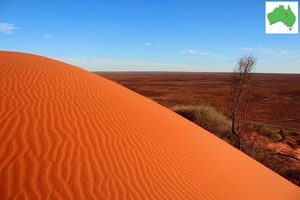
176,500 square kilometers
A mixture of rolling red dunes and flat plain spinifex.The Tanami Desert:
185,500 square kilometers of brutal life-sapping scrub and spinifex.
The Great Sandy Desert:
156,000 square kilometers of Spinifex and sand dunes.
The Gibson Desert:
155,000 square kilometers.
large portions of the desert are characterized by gravel-covered terrains covered in spinifex.
It also contains extensive areas of undulating red sand plains and dune fields and low rocky ridges.The Victoria Desert:
The Victoria Desert is the largest desert in Australia covering 983,482 square kilometers.
– Over three times larger than Italy (301,338 km).
That’s 1/4 as large again as Texas (695.882 square kilometers).
Australia actually has ten deserts.
The others are:
The Little Sandy Desert (111,500 square km), Strazleki Desert (80,250 square km), Sturt Stony Desert (57,710.6 square km), Tirari Desert (15,250 square km) and the Padirka Desert (1,250 Square km).The Daintree Rainforest:
The Daintree is a 1,200 square kilometer tropical rainforest on the northeast Queensland coast. It’s a world heritage site and the oldest rainforest in the world.
It’s also one of the most ecologically diverse regions on the planet.It contains 30% of the frog, reptile and marsupial species found in Australia.
90% of the bat and butterfly species. 7% of bird species and over 12,000 known species of insects.Gosses Bluff Meteor Crater:
Gosses Bluff (Tnorala to the Western Arrente people) is an eroded impact crater 175 kilometers west of Alice Springs.
It was formed by the impact of an asteroid or comet approximately 142.5 million years ago.
It’s 5 km (3.1 mi) diameter, 180 m (590 ft) high.
It was much higher but again has eroded over the eons.
Indeed, these are the inner rings, the outer rings have completely eroded back into the surrounding plains.The 12 Apostles:
Comprised of sandstone and formed by erosion and exposure to the harsh elements of the Southern Ocean they oddly never included 12 stacks and of the original eight, only seven remain after one succumbed and finally crumbled into the ocean in 2005.
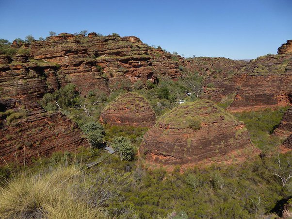
12 Kings Canyon:
Water is the single most valuable resource in central Australia and Kings Canyon is one of the few permanent sources.
(Also an instructive photo to show how rust forms and breaks down our geology)Glass House Mountains:
The range was formed as molten lava cooled to form granite in the cores of volcanoes which then eroded leaving the granite exposed approximately 27 million years ago.
Jenolan Caves:
The Jenolan Caves are a limestone system and are the oldest open (accessible) caves in the world. They cover more than 40 kilometers (25 mi) of multi-level passages and have over 300 entrances.
The road into the [hidden] valley actually passes right through one of them.
It’s the only way in or out of the valley.Fraser Island:
I currently live 70 meters off a contextually remote beach on the Great Barrier Reef directly opposite the northern point of Frazer Island and can see it on clear days from my back door and windows.
123 kilometers (76 mi) long and 22 kilometers (14 mi) at its widest point, Frazer is the largest sand island in the world and another World heritage site and national park.
It’s prized for its white sandy beaches and high ecological diversity, particularly its Green and Loggerhead turtle rookeries and population of Dingoes.The beach and broader coastline I live on is fluid and changes shape regularly.
Every six months the river mouths move up and down the beaches several kilometers and back again as the coastline shifts and reforms. This is because this is the very sand that Frazer Island robs and returns each year in an endless cycle.
(also the reason some of my answers allude to me spending much of my time neck-deep in the Mangroves and dunes relocating Turtle nests).Wave Rock:
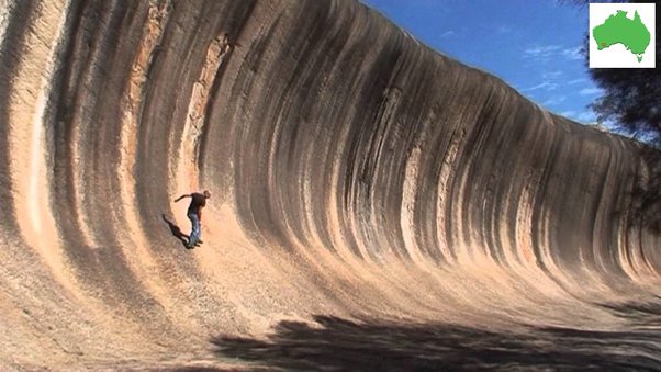
Wave Rock is a natural rock formation shaped like a tall breaking wave.
The “wave” is about 15 m (49 ft) high and around 110 m (360 ft) long.Black Mountain:
Black Mountain, located in Black Mountain National Park west of Cairns is a 108 meter tall mass of millions of black granite boulders dated at almost 300 million years.
They formed when volcanic subterranean lava set into granite and was eventually exposed through erosion and heated by the sun and cracked over millennia (sometimes explosively).The Kimberly:
The Kimberley is an area of limestone and sandstone gorges and plateau’s 423,517 square kilometers (163,521 sq mi), which is about three times the size of England.
Arnhem Land:
The area covers about 97,000 square kilometers and has an estimated population of 16,000, of whom 12,000 are indigenous.
Arnhem Land is a mix between vast tracts of wetland, granite outcrops and plateaux intermixed with heavy vegetation.
Its climate is tropical monsoon with a wet and dry season.Lord Howe Island:
An irregularly crescent-shaped volcanic remnant only 14.5 miles long, Lord Howe was uninhabited until Europeans discovered it in the 18th century but it wasn’t settled until 1834.
UNESCO records Lord Howe as a World Heritage site of global significance.
Lord Howe’s primary revenue stems from tourism with some commercial fishing.
Only 347 people reside on the island full time.The Finke River:
The oldest river course on the planet.
Again I’ve spent much of my life in the most remote regions of the Finke and it’s another one of those places in Australia where the age of the continent literally rises up out of the ground.Kakadu National Park:
While Kakadu is nothing like beautiful Yellowstone it is similar in terms of its incredible ecological diversity and preeminence within the Australian landscape.
Australia has 285 national parks. The highest number in the world and 80 more than China, its next closest competitor. It also has 19 World Heritage sites such as The Great Barrier reef, The Daintree Rainforest, Uluru, Shark Bay, Frankin River National Park, and Kakadu amongst many others.Located on the confluence of the East Alligator River system Kakadu is primarily (though not exclusively) wetland. It has a tropical climate, relies upon wet and dry seasons and monsoonal rainfall.
It covers an area of 19,804² km (12305 sq mi)- almost identical to the Florida Everglades, 20,202 km² (12552 sq mi).Aboriginal people have occupied the Kakadu area continuously for at least 65,000 years, indeed its northern coastline is believed to be the location of their first arrival on the Australian continent and Kakadu is renowned globally for the richness of its Aboriginal cultural sites and rock art.
The Gap:
Located just outside Albany in Western Australia this is a really interesting geological site.
It’s the exact point where Antarctica broke away from the Australian south coast and the rocks in this photo actually match the rocks on the northern coastline of Antarctica.Coober Pedy:
Coober Pedy is unique.
There’s no other town like it in the world.
It produces 85% of the world’s opal supplies.
It’s remote and it’s hot and it’s arid.
To escape the heat many of the miners live underground in homes they carve out of the chalk and while they’re all dirty, sweaty hard-working miners, half of them are multi (MULTI) millionaires but you would never even begin to pick it.
Probably the highest population of millionaires per capita in the country.
Perhaps in the world?
It would have to come close.Palm Valley:
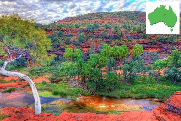
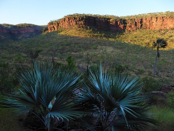
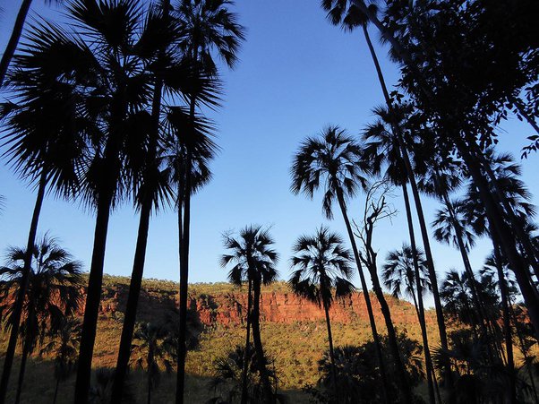
Located in the Krichauff Range, 138 kilometers southwest of Alice Springs, Palm Valley is a spring-fed oasis of enormous cultural significance to the Western Arrantar people and another very rare (almost) permanent water source.
It is assumed that the Cabbage palms are the last surviving remnants of the prehistoric rainforests that once blanketed most of central Australia.Queensland Lava Tubes:
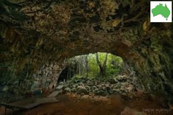
The only location on this list I have not personally been to.
Formed relatively recently from basalt, they are less than 3 million years old.
There are five separate tubes and each is around 30 kilometers long though before they collapsed they were estimated to be around 100 kilometers long.
(edit) – added later, Christmas Island which I have also never been to.Western Australian stromatolites, Shark Bay:
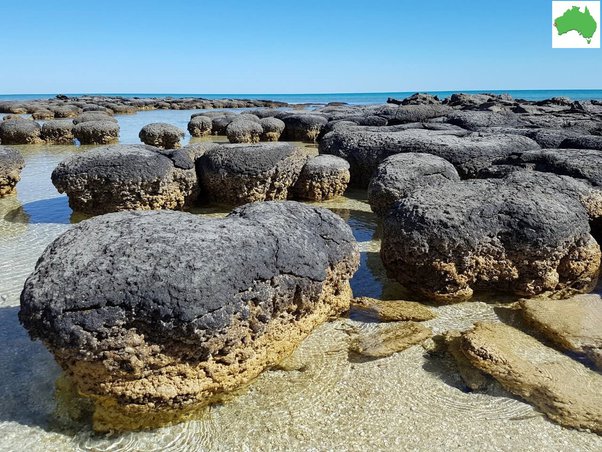
Stromatolites are layered mounds, columns, and sheet-like sedimentary rocks that were originally formed by the growth of layer upon layer of bacteria.
Shark Bay in Western Australia is one of only two places in the world where living marine stromatolites still exist.
These ancient structures are examples of what life on Earth was like 3.5 billion years ago and are considered living fossils and are the earliest record of life on earth.
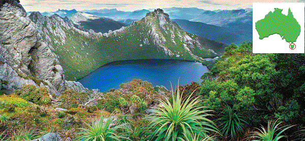
They were vital because it was they who created the oxygen we breathe and enabled life to evolve.Tasmania:
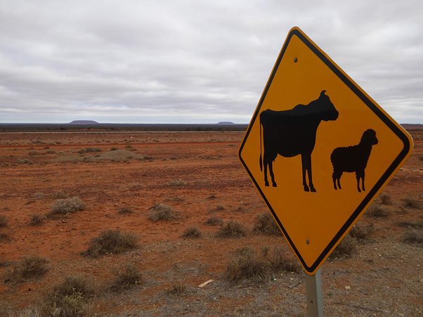
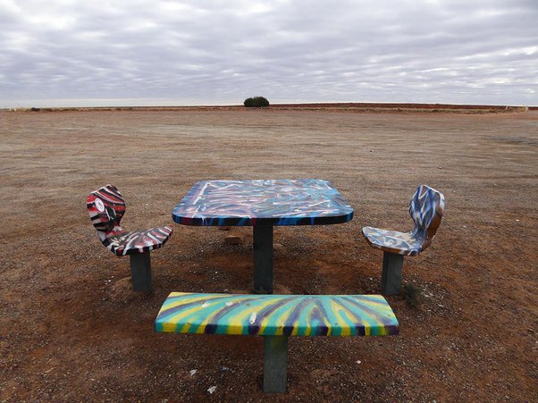
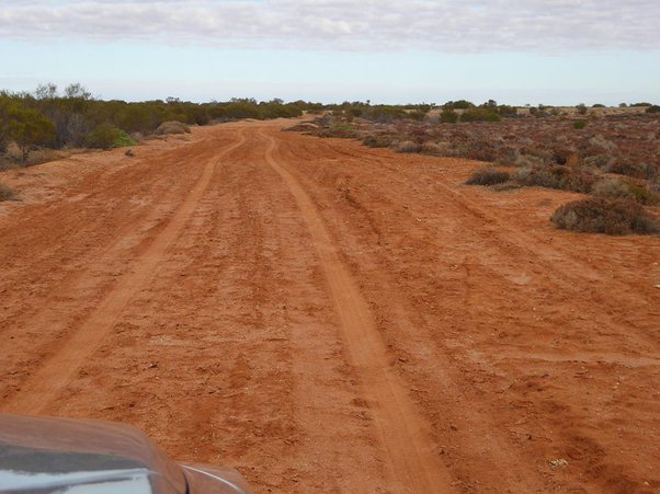
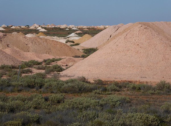
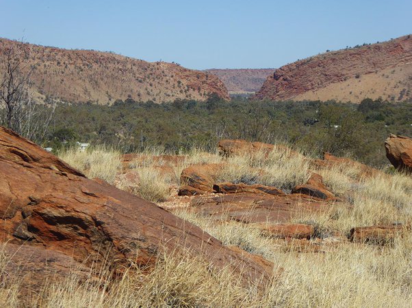
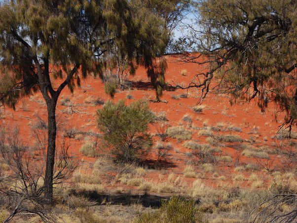
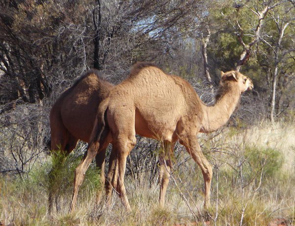
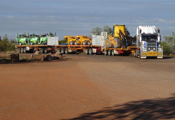
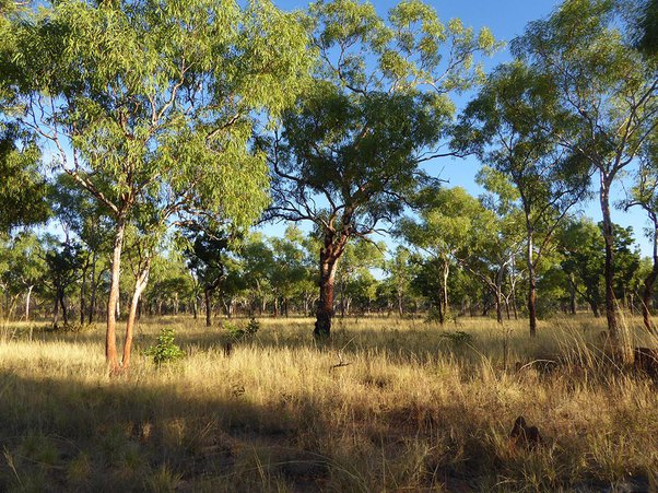
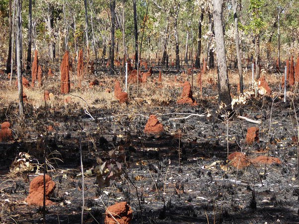
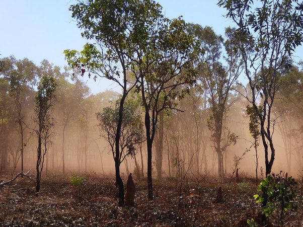
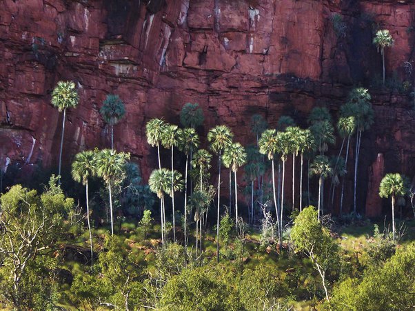
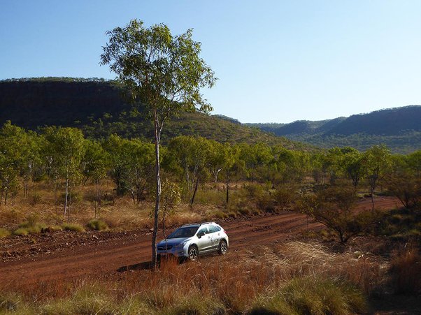
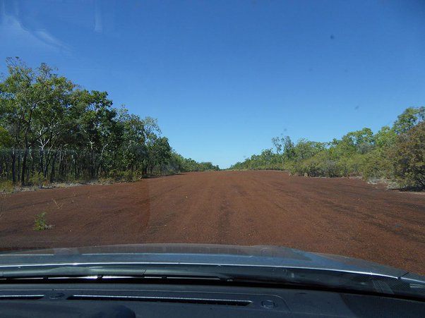
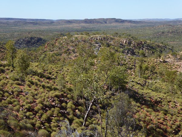
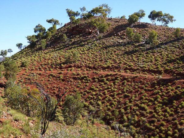
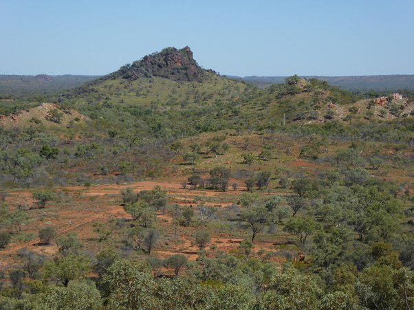
Here are some photographs I have taken driving through the outback. It can be desolate, but if you don’t stray too far from the main roads, you can still experience it without too much danger. Don’t go in the middle of summer. Winter is best.
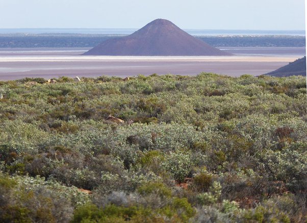
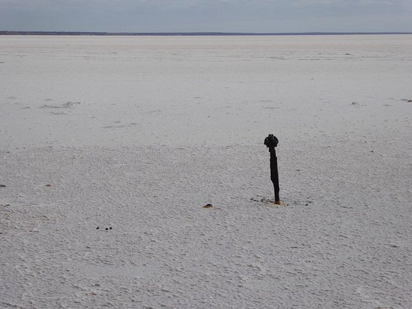
Salt Lake.
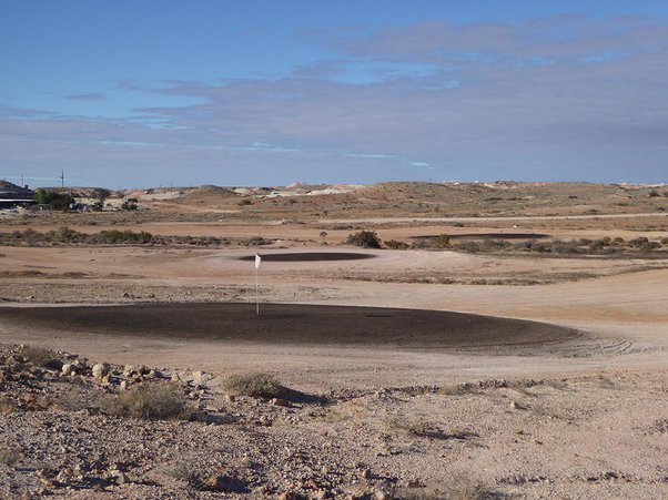
Coober Pedy golf course
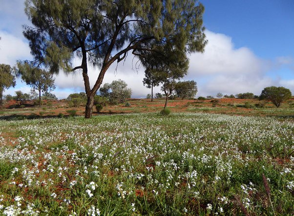
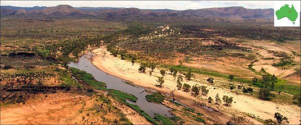
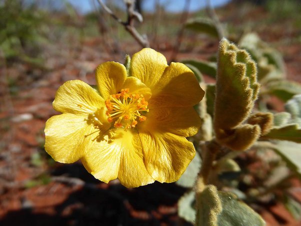
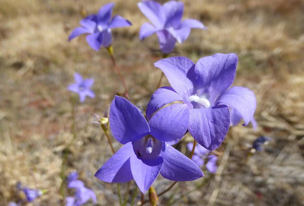
There are times when the outback blooms. Below, the cap is the entrance to Alice Springs
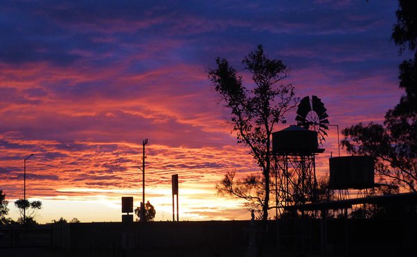
Sunset at Ti Tree
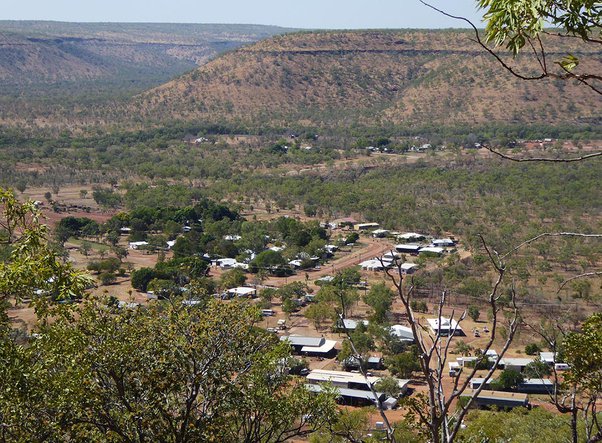
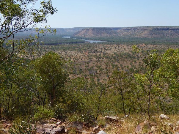
Timber Creek, population 249
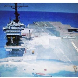
Above: Abandoned second world war airstrip in the bush.
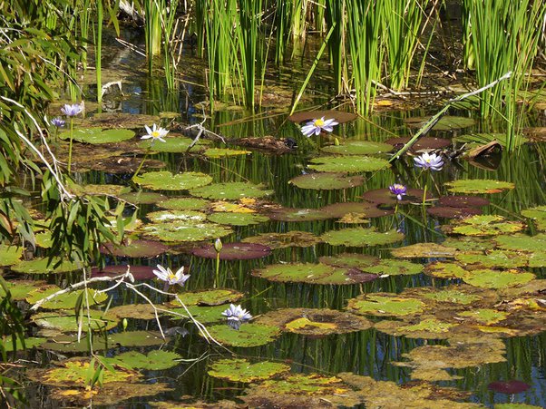
Below: The outback is not all dry.
Clear skies; far views, with no sign of habitation.
Like an Aboriginal dot painting.
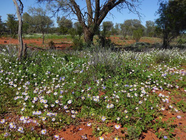
Again the outback blooms 🙂