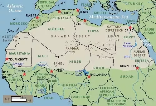
The Sahara, Arabic for desert, stretches across North Africa. The Sahara is the world’s largest non-polar desert, over 9,000,000 km² (3,500,000 mi²), which is about the same size as the United States.
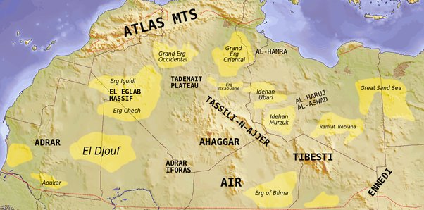
Although the Sahara is famous for sand-swept dunes, the majority of the surface is comprised of hamada or rocky plateau. The Sahara’s fabled dune fields cover only about 15% of the entire desert’s surface and lie primarily in the north-central region. In the dune laden sections of Algeria and Libya, the sand thickness varies because dunes can pile up to a height of several hundred meters, but then change as the sand moves.
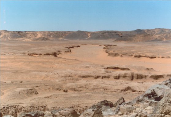
The desert expanse is dominated by rocky barren stretches with arid hills and valleys.
What many do not realize is the Sahara was once a fertile area that supported thriving human communities. A study of cores revealed that North Africa’s ancient climate underwent swift desertification and a climate shift transforming the region from a humid, subtropical landscape to desert within a matter of years. This occurred around 4200 B.C. It returned to the same desert conditions that dominated the area 13,000 years earlier.
When the climate began to change, the Sahara region became parched and the vegetation died away. With nothing to hold the soil, wind action was able to remove all of the fine sediment until only sand, rocks, and bedrock remained.
PROBABLE CAUSE
The change from the mid-Holocene climate to that of today was initiated by changes in the Earth’s orbit and the tilt of Earth’s axis. Some 9,000 years ago, Earth’s tilt was 24.14 degrees, as compared with the current 23.45 degrees, and perihelion, (the point in the Earth’s orbit that is closest to the Sun), occurred at the end of July, as compared with early January now. At that time, the Northern Hemisphere received more summer sunlight, which amplified the African and Indian summer monsoon.
The changes in Earth’s orbit occurred gradually, whereas the evolution of North Africa’s climate and vegetation were abrupt. German researcher Claussen and his colleagues believe that various feedback mechanisms within Earth’s climate system amplified and modified the effects touched off by the orbital changes. By modeling the impact of climate, oceans, and vegetation both separately and in various combinations, the researchers concluded that oceans played only a minor role in the Sahara’s desertification.
FUN FACT
Wadi El Hitan, (Whale Valley), in Egypt contains the fossilized remains of an extinct sub-order of whales. Evidently, the valley was part of a shallow marine basin 40–50 million years ago. The desertification helped both preserve and reveal a tremendous hoard of fossils.
Our knowledge of the depth of sand in the Sahara comes from a variety of sources, including geological surveys, satellite imagery, and field studies…
Geological surveys have been conducted in many areas of the Sahara, and these studies help us to understand the composition and structure of the rock formations underlying the sand. (Geologists can also use geophysical methods, such as ground-penetrating radar, to study the subsurface geology and better understand the depth and characteristics of the sand).
Even though the geology of the Sahara is quite complex and there is a lot of variation across the region, in general, we can say that the sand range from a few meters deep to over 150 meters deep in some areas.

- The sand of the Sahara is about 21–43 m (69–141 ft) deep.
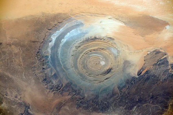
- The Sahara is 9.2 million km² in area, of which was 109,000 km² lake bed. the rest was mixed hill and valley terrain, plus there is the “Eye of the Sahara” crater.
